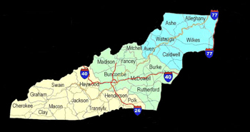
Graham
County is practically enclosed
by rugged towering mountains on all sides. The western range
of the Great Smoky Mountains separating Graham from Tennessee
is called the Unicoi Mountains. The southern boundary is
the Snowbird Mountains circling to Red Marble Gap, then
swinging northward to Cheoah Bald. The northern border is
the Little Tennessee River inundated by Fontana Lake. The
Cheoah range and the Yellow Creek Mountains traverse the
northern part of the county completely boxing in Graham
County on all sides with the exception of the rocky gorge
of the Cheoah River below Lake Santeetlah where the Little
Tennessee enters Tennessee. It is then indeed little wonder
that this region was one of the last regions of Western
North Carolina to be settled by the white men. Graham County,
a part of the Cherokee treaty lands, was not opened to settlement
until President Jackson ordered the removal of the Indians
in 1838.
In 1838 there was not a road in Graham
County except the old Indian trading paths. There is no
record of travel by white man across the mountains of Western
North Carolina prior to the famous pilgrimage of Daniel
Boone in 1769. However, it is believed that Desoto in 1540
was the first white man to look upon the Great Smoky Mountains.
It is possible that Boone and later pioneers followed these
old Indian paths and other trails made first by deer, bear
and other game as they sought the easiest way to travel
from one feeding area to another.
William Bartram, the first great
botanist born in America, was one of the first white men
to see the land which was destined to be Graham County.
Bartram roved the hills and woodlands collecting and setting
down notes of the plant and animal life of this Appalachian
area, all of which is recounted in detail in his classic
work, The Travels of William Bartram. He established a rapport
with the Indians probably unmatched except for Daniel Boone.
His lovely descriptions have a poetic favor which only a
master naturalist with his intense love of nature could
have fathomed. According to Hiram C. Wilburn of Waynesville
who traced William Bartram's 1776 trip through the mountains
of Western North Carolina, Bartram came "about 6 or
7 miles down the Talulah towards Robbinsville" where
he spent the night of May 27, 1776. He decided at this point
to postpone his search until another time. The reason for
his discontinuing of?his research in this area is unknown,
but he apparently did not return again to this region.
It is probable that John and Robert
Stratton followed one such trail when they crossed over
from Monroe County, Tennessee, during the 1830's and settled
on Stratton Bald in the Unicoi Mountains between Sassafras
Ridge and Santeetlah Creek. John lived there for ten years
and reportedly caught 19 panthers on old Laurel Top, making
"panther bacon" of their shoulders and hams, thus
earning the nickname "Bacon John." He arrived
on Stratton Bald with nothing but his rifle, blanket, cooking
utensils and ammunition but earned enough herding cattle,
selling deer, bear hams and hides to buy a fine farm in
Tennessee.
Ironically, the first wagon road
in Graham County was brought about by the Removal itself.
Soldiers under orders from General Winfield Scott moved
into the area and erected Fort Montgomery on the Indians'
ballground. The area overlooking Robbinsville is the present
location of the American Components plant and the 28 houses
built by the Rural Development Authority. Fort Montgomery
was constructed under direction of Dr. Dan F. Summey of
Asheville for use in corralling the Indians in 1838 prior
to removal to Oklahoma. A makeshift highway was built from
Old Valley Town (Andrews) to Fort Montgomery near Robbinsville
for use of the soldiers in evacuating the Indians.
Over this first wagon road came the
first preacher?Reverend Joseph A. Wiggins, a distinguished
Methodist Minister. The Rev. Joseph A. Wiggins, father of
the late Walt Wiggins, was born on Alarka Creek in 1832,
but moved to Graham County with his father Abraham in 1840.
He found a few hardy white families. In the. valleys, the
Cherokees had their villages where they raised corn, barley,
pump kins and ceremonial tobacco while ' they hunted wild
game on the rugged mountain slopes.
There were no mills except a few
grist mills. Wheat was "packed" on horses by an
Indian trail a distance of about thirty miles to a mill
five miles from what is now Bryson City. Indian relics were
plentiful at that time at the Meadows on the head of Tallulah
Creek.
Mr. Wiggins married a daughter of
George W. Hayes for whom the town of Hayesville was named.
There was not a church in the county and only a few log
houses. He began preaching in 1859, and served for four
years as chaplain in the Confederate Army. Afterwards he
rode circuits in Southwestern Virginia, East Tennessee and
Western North Carolina remaining stationed in Graham County.
His great-grandfather Garland Wiggins and his wife's great-grandfather
Edward Hayes served in the Revolutionary War.
Early history records only three
families living in Graham County, known as Cheoah Valley
at that time, prior to the arrival of the Wiggins family
from Swain County. The three families were: Billy Crisp,
who came from Haywood County, and settled near where Mountain
Creek flows into Cheoah River and later moved to the Stecoah
Community. Billy Crisp was an ancestor of Joel L. Crisp
who served four terms as State Senator around the turn of
the century. John Hyde settled near the old Ernest Cooper
place on Highway 129 and put up the first gristmill in Cheoah
Valley on a small stream named Hyde's Mill Creek. Isaac
Rowen settled opposite the residence of John Hyde on the
other side of the Tallulah River where was located more
recently the farm of Rube Rogers who married the daughter
of the pioneer settler. A little later of the same year
Thomas Cooper came from Haywood and settled on Frank's Creek.
Andrew Colvard reportedly lived on
Long Hungry Branch during this early period. The branch
got its name from the fact that a party of hunters once
was detained there by high waters until their rations gave
out and they were hungry for a long time. The Stewarts of
Santeetlah came from Georgia and the Lovins from Ducktown,
Tennessee.
Other early settlers were: James
Colvard who came from Tennessee and set up on Tallulah;
the Sherills from Haywood settled in eastern portions of
the county; Baxter Campbell settled near the West shore
on Tallulah; James Carver from Tennessee near the mouth
of West Buffalo; John Ammons below Robbinsville; Doctor
Enos Hooper for whom Hooper's Bald was named went to West
Buffalo; William Colvin came from Buncombe in 1850 and lived
on Cochran Creek; Harwoods and Dentons settled on Sweetwater.
Other early families were: Carpenter, Rhea, Rose, Phillips
and Rice.
In the Yellow Creek section, the
early families were: Birchfields, Williams, Sharps, Colvins
and Johnsons from Tennessee. There were also the Shulers
from Jackson County, Garrisons from Kansas, Ditmores from
McMinn County, Tennessee, and Isaac Carringer from the eastern
part of the state.
In the Stecoah Section were the Crisps,
Taylors, Sawyers, Gunters, Deans, Cables and Welchs. It
was also about 1840 that a land F rant was taken by Edward
Delozier on what is now called Sawyer's Creek. In 1843 the
Medlins moved from Macon County to Wolf Creek, a tributary
of Panther Creek in the Stecoah section. Descendants of
this family still own this original State Land Grant.
Some time between 1840-1843 Thomas
Cooper and Col. William H. Thomas established a trading
post on Rhea Hill on the present Robbinsville school site.
This store later remodeled and expanded by George Walker
was operated by Thomas Cooper and is believed to be the
first store in this section. A little later Wiley King moved
to this area and replaced Thomas in the enterprise, and
the store became King-Cooper Store. The first post office
was established in 1843 housed in the King-Cooper Store
with Wiley King as the first postmaster The post office
was originally listed as Cheoah Valley, changed to Fort
Montgomery in 1849, and still later in 1874 the name was
changed to Robbinsville.
| WNC Outdoors | WNC Waterfalls |