Macon County

Click here to access county information for western North Carolina.

Cities/Towns: Aquone - Culiasaja - Franklin* - Gneiss - Highlands - Kyle - Lotla - Norton - Otto - Rainbow Springs - Scaly - Wests Mill

Unique places: Bartram Trail Society - Bridal Veil Falls - Dry Falls - Ghost Tours - Fire Mountain - Fun Factory - Mountain High BBQ - Museums - Nantahala National Forest - Overlook Theatre Company - Scottish Tartans Museum - Waterfalls

Local Newspaper (s) - (Community News) - The Franklin Press, Macon County News & Shopping Guide, The Highlander, Highlands Newspaper Internet Dir.

Discover information about the area you want to visit.  Then click on Campgrounds and RV Parks. Carolina.

Search for more details using Google's standard search engine.

Search for more details using Yahoo!'s All the Web basic search engine.

Click on an area in western North Carolina to visit online related camp grounds and RV parks.  Make reservations and see photos.
Western North Carolina Area Info Mountain Activities Campgrounds


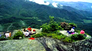
The North Carolina Bartram Trail Society maintains a 100 mile memorial trail in the state of North Carolina, in honor of the Philadelphian naturalist, William Bartram, who traveled throughout the southeast from 1773 to 1777.
Courtsey Bartram Trail Society
Bartram Trail Society


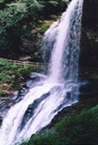
You can find Dry Falls from a short, easy walk. Even better, you can walk right behind the falls without getting wet! A well-marked path and hand rail to guide you behind and around the 75-foot curtain of rushing water. Long before the first settlers arrived the fertile mountains of southwestern North Carolina were home to the Cherokee Indian Nation. In a valley surrounded by some of the oldest mountains on earth, the Cherokee called the land that is now Franklin “Nikwasi” or “center of activity”.
Courtsey Chamber of Commerce Courtsey Chamber of Commerce
Dry Falls Franklin Treasures


A Brief History of the Formation of Macon County

Source: History

Macon County was created in 1828 from Haywood Co., NC, and named for Nathaniel Macon of Warren Co., NC. The land from which Macon County was created was part of the lands ceded by the Cherokee in the 1819 Treaty. Before that, the "settled" line, set in 1802, ran through what is now Jackson County, NC.

It is widely believed that there were white settlers in Western North Carolina before 1802, however. This belief is supported by an 1820 survey done by Capt. Robert Love in this area. Capt. Love noted which land lots were already settled, a few by "Indians" but many more by white squatters.

In 1839, Cherokee County was created from Macon County, and in 1851, Jackson County was created from parts of Macon and Haywood Counties.

Franklin is the county seat of Macon County. Other towns and communities are Otto, Tessentee, Scaly Mtn., Highlands, Cullasaja, Iotla, Nantahala, Cartoogechaye, Burningtown, Ellijay, Gneiss, and Cowee, to name a few.
 

| WNC Outdoors | WNC Waterfalls |


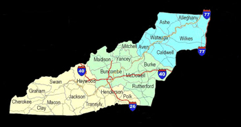
Return to County Map of Western North Carolina

* County Seat


"Freedom is Knowledge"